Urban and Regional Structure Plans
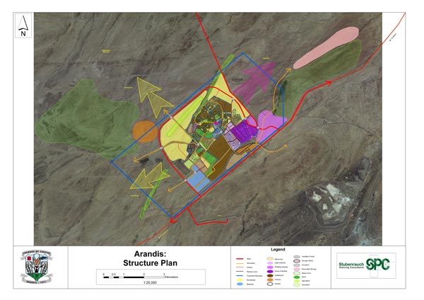
A Structure Plan or Integrated Land Use Plan is a tool for guiding development within a town or a region for a period of time being 15, 20 or 30 years. Structure Plans are not a statutory document and can be adapted if and when required. The plan is to be transparently prepared in close consultation with Local Authority and the community. The aim of the plan is to guide urban development over a long term while also informing the public and investors of the vision for the town.
SPC has undertaken a number of urban structure plans for:
Ongdangwa
Arandis
Nkurenkuru
Outjo - ongoing
Khorixas ongoing
Mariental ongoing
Otjiwarongo ongoing
Rundu - ongoing
SPC has also been involved with the new modelling approach for Integrated Regional Land Use Planning (IRLUP) driven by the Ministry of Lands and Resettlement and has completed the Karas and Hardap Integrated Regional Land Use Plans and is currently in the process of facilitation of the Kavango Integrated Regional Land Use Plan. Integrated Regional Land Use Plan is a new modelling approached aimed at allocating the most suitable and sustainable land use within a region and provides development scenarios for the region based on participatory land use planning tools. These Integrated Regional Land Use Plans are also are also supported by a regional GIS database system.